Loading...
DE
FR
NL
Memories
Discover the Saarland region
We’re in love ...
Dibbelabbes
We really didn’t want to retire!
Themes
Food & Drink
Culture
Families
Accomodations
Information
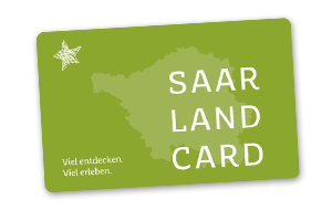
Saarland Card
Trips & Tours
Sustainable travel
Barrierefreies Reisen
Groups
Brochure order
Video & Webcam
+49 681 927200
Experience
Routes
Active in nature
Hiking
Cycling
Food & Drink
Genuss Region Saarland
Restaurant guide
Michelin star awarded cuisine
Culture
Family time
Wellness
Plan & book
Accommodation & Packages
Saarland Card
Sustainable travel
Accessible tourism
Groups
Service & contact
Contact
Broschures
Saarland Card
One card for amazing benefits!
Legal notice
/
Privacy statement
Keep in touch with us